

Top 5 Hikes Near San Francisco: Best Spots to Explore Nature
San Francisco is more than just iconic bridges and steep city streets, it's a gateway to some of the most breathtaking hiking experiences in California. Whether you're a seasoned trail enthusiast or a casual nature lover looking to escape the urban hustle, the Bay Area offers incredible hiking opportunities right at your doorstep. From coastal cliffs and old-growth redwood forests to panoramic city views, here are the top 5 hikes near San Francisco that will transform your weekend adventures.
1. Lands End Trail: Coastal Beauty Meets Urban Adventure
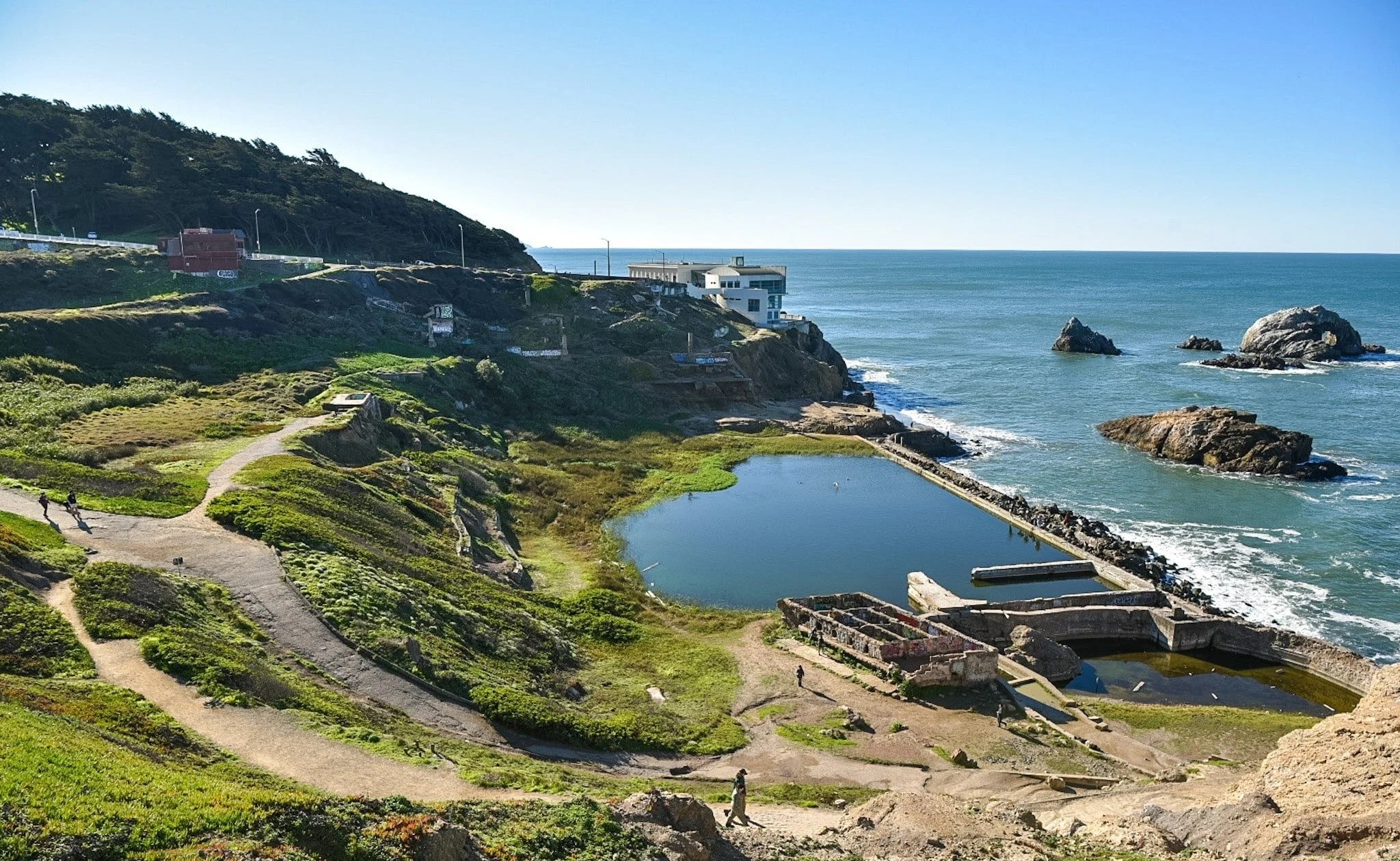
The Lands End Trail is the crown jewel of San Francisco's coastal hiking. This scenic 3.4-4.5 mile trail hugs the rugged western coastline, offering breathtaking views of the Golden Gate Bridge, dramatic cliffs, and the iconic Sutro Baths, one of San Francisco's most unique and photogenic attractions.
Trail Details
- Difficulty: Easy to Moderate
- Distance: 3.4-4.5 miles
- Elevation Gain: 500-600 feet
- Trail Type: Point-to-point or out-and-back
- Dog-Friendly: Yes, on a leash
- Best Time to Visit: Year-round; clearest views in fall and winter
Why Hike Lands End?
If you haven't explored San Francisco's hiking yet, Lands End is the perfect starting point. The trail is relatively flat for most of the journey, making it accessible to hikers of varying fitness levels. What makes this hike special is the combination of stunning Pacific Ocean views, the dramatic rugged coastline, and the opportunity to visit the historic Sutro Baths ruins, all without needing to venture far from the city.
The trail winds through coastal scrub and eucalyptus groves before opening up to spectacular ocean vistas. On clear days, you can see all the way to the Marin Headlands and Point Reyes.
Pro Tips
- Start early to beat the crowds, especially on weekends
- Bring layers - it's notoriously windy at the cliffs, even on warm days
- The trail is often shrouded in fog during summer months; visit in late spring or fall for clearer views
- Don't miss the Sutro Baths photo opportunity near the end of the trail
- Street parking is available at the Lands End Parking Lot (48th Avenue and Point Lobos Avenue)
2. Twin Peaks Trail: 360-Degree City Views
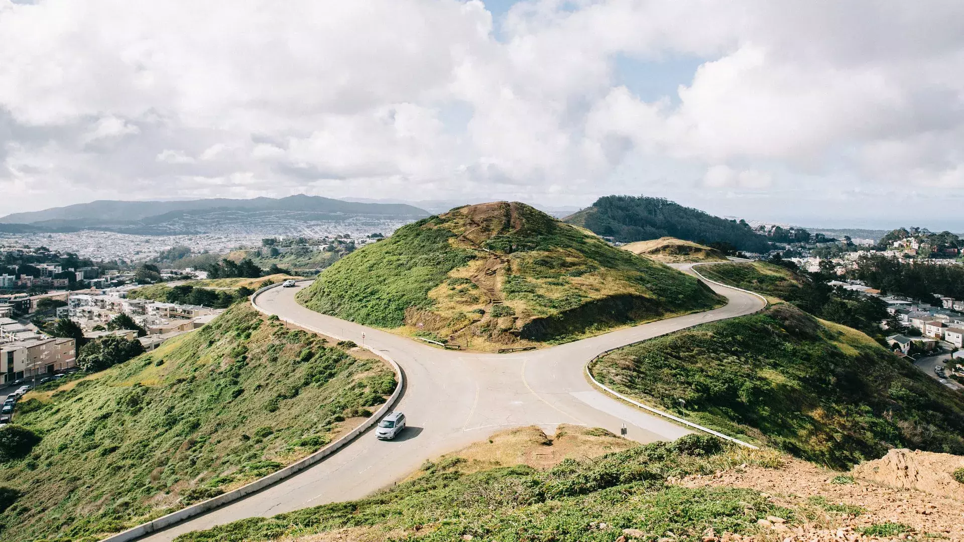
For those seeking heart-pumping elevation gain combined with unbeatable panoramic views, the Twin Peaks Trail is your destination. This iconic San Francisco hike climbs to the city's second-highest natural point, rewarding you with a breathtaking 360-degree vista of the entire Bay Area.
Trail Details
- Difficulty: Moderate
- Distance: 2.1 miles
- Elevation Gain: 750 feet
- Trail Type: Out-and-back or loop
- Dog-Friendly: Yes, on a leash
- Best Time to Visit: Clear days for optimal views; avoid fog-heavy summer months
Why Hike Twin Peaks?
The Twin Peaks Trail is a short but challenging climb that packs a punch. Unlike many San Francisco hikes, this trail delivers serious elevation gain in a compact distance, making it ideal for those with limited time but high fitness levels. The payoff is extraordinary, at the summit, you'll see downtown skyscrapers, the Bay Bridge, the Golden Gate Bridge, and on exceptional clear days, even Mount Diablo in the distance.
The trail ascends through urban neighborhoods before opening onto exposed slopes with increasingly expansive views as you climb higher.
Pro Tips
- Always bring a windproof jacket, the summit can be incredibly windy, even on mild days
- Avoid midday hikes on hot days; the exposed terrain offers little shade
- The trail is often busier on weekends; visit on weekday mornings for a more peaceful experience
- Parking is available at the base of Twin Peaks (Christmas Tree Point trailhead) or along nearby residential streets
- The twin peaks themselves are adjacent to each other, so you can summit both with minimal extra effort
3. Glen Canyon Park Trail: Hidden Urban Oasis
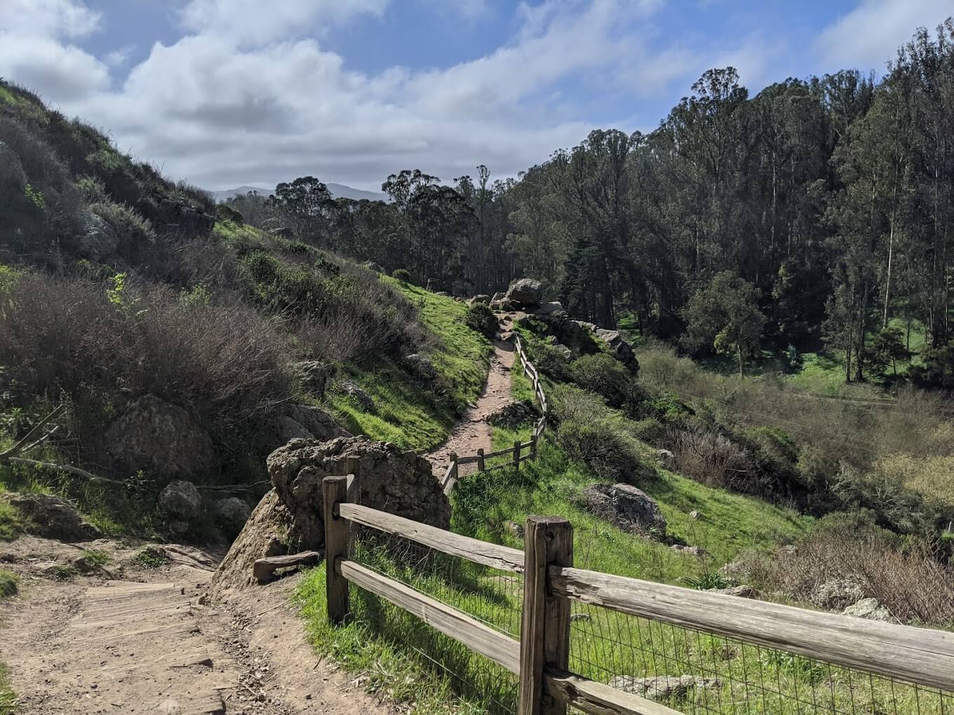
Nestled in the heart of San Francisco, Glen Canyon Park is a hidden sanctuary that feels worlds away from the bustling city streets. This 1.8-mile trail winds through a deep canyon, offering a diverse ecosystem of native plants, wildlife, and serene forest environments.
Trail Details
- Difficulty: Easy to Moderate
- Distance: 1.8 miles (various loop combinations available)
- Elevation Gain: 250 feet
- Trail Type: Loop
- Dog-Friendly: Yes, on a leash
- Best Time to Visit: Spring for wildflowers; year-round for lush vegetation
Why Hike Glen Canyon?
Glen Canyon Park is a local secret that offers an escape from the urban landscape without leaving the city. The trail descends into a deep canyon where you'll encounter a gentle creek, grassy meadows, native plants, and even opportunities to spot red-tailed hawks circling overhead. It's a perfect choice for those seeking a gentler hike with maximum nature immersion.
The canyon creates its own microclimate, keeping the area cool and green year-round, even during San Francisco's dry summers.
Pro Tips
- The trail is less crowded than other San Francisco hikes, making it ideal for peaceful nature walks
- Bring water and wear sturdy footwear, some sections can be muddy, especially in winter
- Parking is available on Bosworth Street or Elk/Chenery intersection
- Spring is the best time to see wildflowers blooming along the canyon floor
- The park has multiple trail connections, so you can customize your loop length
4. Bernal Heights Park: 360-Degree Urban Panorama
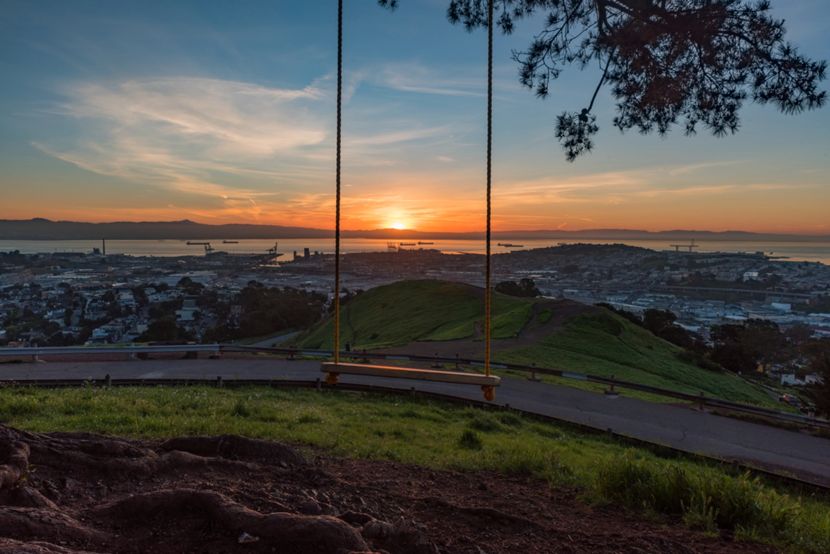
Rising prominently above the Castro neighborhood, Bernal Heights Park offers one of San Francisco's most accessible yet rewarding summit hikes. This 1-mile loop trail winds up a grassy knoll, providing sweeping 360-degree views of the city skyline, the Bay Bridge, and the Golden Gate Bridge.
Trail Details
- Difficulty: Easy to Moderate
- Distance: 1 mile loop
- Elevation Gain: 200 feet
- Trail Type: Loop
- Dog-Friendly: Yes, on-leash paths available
- Best Time to Visit: Clear mornings or golden-hour evenings for photography
Why Hike Bernal Heights?
Don't let the short distance fool you, Bernal Heights delivers big on views with minimal effort. This is one of San Francisco's favorite urban hikes, beloved by dog walkers, photographers, remote workers seeking a lunchtime escape, and visitors wanting quick access to panoramic vistas. The grassy hilltop offers open-sky views and feels surprisingly wild despite being in the middle of the city.
Pro Tips
- The summit tends to clear clouds and fog, so even on hazy days, you may find clear skies at the top
- Visit on a clear evening for spectacular sunset views and city lights photography
- Parking is available at 3450 Folsom Street, with designated dog parking areas
- The trail has a few steep sections, so bring water even though it's a short hike
- The park is a popular social hub, so expect to see other hikers, especially on weekends
5. Mount Sutro Open Space Reserve: Enchanted Forest Escape
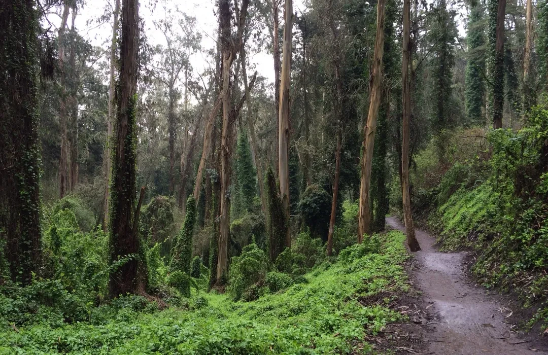
In the heart of San Francisco lies a hidden forest that feels like stepping into a fairytale, Mount Sutro Open Space Reserve. This 2.5-mile loop trail winds through a dense eucalyptus forest, providing a unique and atmospheric hiking experience in the middle of the urban landscape.
Trail Details
- Difficulty: Moderate
- Distance: 2.5 miles (main loop)
- Elevation Gain: 600 feet
- Trail Type: Loop
- Dog-Friendly: Yes, on a leash
- Best Time to Visit: Summer when the forest creates a cool, misty refuge
Why Hike Mount Sutro?
Mount Sutro is special because of its unique microclimate. The dense forest canopy traps moisture, creating a perpetually foggy, misty environment that feels like a different world entirely from the surrounding neighborhoods. This makes it the perfect escape on hot summer days when other parts of San Francisco are scorching.
The trail offers a steady incline through towering eucalyptus and redwood trees, surrounded by lush undergrowth and ferns, creating an almost mystical forest atmosphere.
Pro Tips
- The forest's moisture means the trail can be muddy and slippery; wear trail shoes with good grip
- Visit on a foggy day, the mist and towering trees create an ethereal, magical atmosphere
- The reserve is managed by UCSF and features several trail connections including the Historic Trail and Fairy Gates Trail
- Parking is available in nearby neighborhoods (Inner Sunset, Forest Knolls); street parking on nearby residential streets
- Bring a light jacket, the forest's humidity and shade make it cooler than surrounding neighborhoods
- The trails are well-maintained and clearly marked, making navigation easy
Planning Your San Francisco Hiking Adventure
What to Bring
When exploring these San Francisco trails, pack smart:
- Water: At least 2 liters, especially for longer hikes like Lands End
- Layers: San Francisco's weather is unpredictable; bring a windproof jacket regardless of the forecast
- Sun Protection: Sunscreen, hat, and sunglasses for exposed trails like Twin Peaks and Bernal Heights
- Sturdy Footwear: Good trail shoes are essential, especially for Glen Canyon and Mount Sutro where muddy sections are common
- Snacks: Trail mix, energy bars, or fruit for sustained energy
- Map or GPS: While these trails are well-marked, having a backup navigation method is wise
Best Times to Visit
- Spring (March-May): Wildflowers bloom; moderate temperatures; can be crowded
- Fall (September-November): Clearest skies; comfortable temperatures; less fog
- Winter (December-February): Fewer crowds; lush vegetation; muddy sections on some trails
- Summer (June-August): Popular but foggy in early mornings; Mount Sutro offers the coolest escape
Difficulty Considerations
These hikes range from easy urban strolls to moderate climbs. Choose based on your fitness level:
- Easy: Glen Canyon, Bernal Heights (short distance)
- Moderate: Lands End, Twin Peaks, Mount Sutro
- Challenging: Twin Peaks (for elevation gain) or extended loops on any trail
Beyond the Top 5: Other Notable San Francisco Hikes
While these five hikes showcase San Francisco's diverse natural attractions, the Bay Area has much more to explore:
- Muir Woods National Monument: 12 miles north of San Francisco, featuring old-growth coast redwood forests
- Mount Tamalpais: Accessible from San Francisco with redwoods, coastal views, and sweeping bay vistas
- Cataract Falls Trail: Waterfall hike featuring cascades and swimming holes
- The Crosstown Trail: 16.5-mile urban trail connecting neighborhoods from Candlestick Point to the Sutro Baths
- Corona Heights Park: Short but steep hike with unobstructed 360-degree city views
Discover San Francisco's Natural Side
San Francisco's hiking trails reveal a side of the city many visitors never experience. From coastal cliffs and redwood groves to urban parks offering panoramic vistas, these five hikes showcase the incredible diversity of nature accessible from the city center. Whether you're seeking a challenging summit climb, a peaceful forest walk, or breathtaking views, San Francisco delivers.
Start with whichever trail appeals to you most, and before long, you'll be exploring the entire network of Bay Area hiking gems. The mountains are calling, it's time to answer.
About Rick, Chief Weed Smoker
Rick is the ultimate cannabis connoisseur and Chief Weed Smoker at Off The Charts, where he combines his love for good vibes and greener pastures with expert insights on all things cannabis. From exploring the best strains to sharing tips for beginners, Rick’s laid-back style and deep knowledge make him your go-to guide in the world of weed. When Rick isn’t testing the latest hybrid, you’ll find him advocating for cannabis culture and crafting blogs to keep our readers informed and elevated. Stay tuned to the blog for Rick’s take on the ever-evolving cannabis industry.